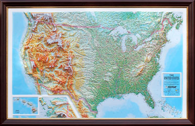
UNITED STATES:
1. Size: (unframed), 44 x 32 inches
2. Scale: 1:4,865,000, or 1″ = approx. 75 miles
3. Vertical Scale: Average height of mountains is 1″ to 3″ from the surface.
4. Vertical Exaggeration: 35 times
5. Territorial Coverage: All of US with insets for Alaska and Hawaii.
a. North includes some of Canada
b. South includes Cuba
10,000 Place Names
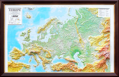
EUROPE:
1. Size: (unframed), 44 x 32 inches
2. Scale:1:7,380,000, or 1” = approx. 116 miles
3. Vertical Scale: Average height of mountains is 1″ to 3″ from the surface.
4. Vertical Exaggeration: 35 times
5. Territorial Coverage:
a) East to West – from Spain to Kazakhstan.
b) North to South – from Scandinavia to Israel.
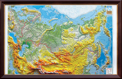
RUSSIA and SURROUNDING COUNTRIES:
- Size: (unframed), 44 x 32 inches
- Scale: 1:8,250,000, or 1” = approx. 130 miles
- Vertical scale: Average height of mountains is 1” to 3” from the surface.
- Vertical Exaggeration: 35 times
- Language: Text is in Russian
- Territorial coverage:
- a) East to West – from Denmark to Kamchatka
- b) North to South – from Arctic Ocean to Himalayas